Bruce’s Briefs: Wx for 8, 9, 10, 11, and 12 Apr. Sloop Tavern Blakely Rock and South Straits Preview.

As if conditions haven’t been crazy enough around here this week, get ready for tomorrow. After a beautiful and warm day yesterday, we had a cold front move through early this morning dropping the temp and some rain. We now have a strong onshore flow coming down the Strait of JdF with an equally strong onshore flow coming into the south Sound through the Chehalis Gap. 33 Knots of westerly at Race Rocks, 26 knots at Dungeness, and 22 knots of WSW at Smith Island. 15-20 knots of WSW from Olympia to Des Moines, 18 knots of southerly at Alki, and 27 knots of SW at West Point and Paine Field. As usual, it has to meet somewhere and thus we have a set-up for the classic Puget Sound Convergence Zone.

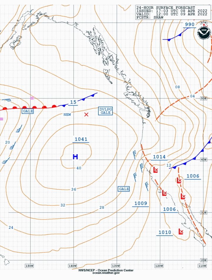
Today’s surface chart and satpPic show the front having gone through and the cool, unstable air behind the front moving into the area. This will mean very cool temps overnight with wind chills in the low to mid-30s for tomorrow with the chance of scattered showers and thunderstorms in the CZ and near the Cascade foothills.

The surface analysis chart for today has a reasonably strong Pacific High at 1038MB off the coast of SF. This will strengthen tomorrow to 1041MB and drift slightly to the north and the west. This will reduce the pressure gradient over the Pacific Northwest as the isobars spread out over the day tomorrow. The real challenge will be for the Race Committee as the models have the Convergence Zone just slightly north of Shilshole. It’s entirely possible there could be a southerly for the early starters and a northerly for the later starters with some very light conditions in between those starts.

After that, the wind could come in from the NE and fill in at 20-knots from the north before it drops back to 5-10 and becomes light and variable. Big fun. Tacticians and trimmers are going to have a very busy day, which will be good because it will keep them from getting too cold.

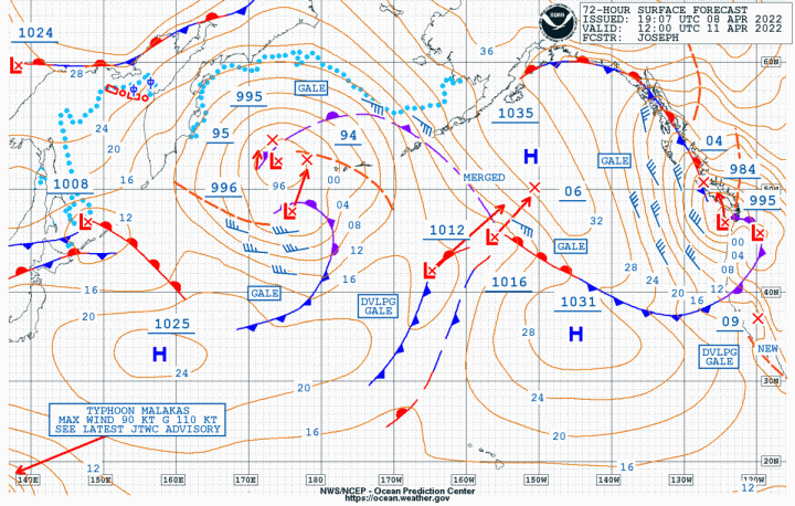
South Straits Preview: It’s a week out and I’m only comfortable with forecasts out 72 to 96 hours but three models will go out to 15 April. They are reasonably consistent in that it looks like you won’t have to worry about too much wind. The most wind seems to be 10-15 knots Friday night from the WNW. Before and after that expect wind in the 3-5 knot range. Lighten the boat as much as possible just remember it will also be quite cool so dress appropriately.

Don’t shoot the messenger.  

Bruce’s Briefs: Wx for 25, 26, 27, and 28 Mar. A typical Spring Weekend!

Today’s surface analysis chart, sat pic, and Langley Doppler radar all combine to show a weakening cold front approaching the coast and moving into the Salish Sea. As it passes over the Pacific NW it will continue to weaken and then stall before it moves slowly off to the NE Saturday night and into Sunday morning.

As this system evaporates over the area we’ll be left with scattered showers and the pressure gradient will decrease over the entire area.  This will mean very light air over the central and south Sound. The north Sound, Admiralty Inlet, and the eastern end of the Strait of JdF will have a light SE breeze of 5-15 knots until about mid-afternoon when that will evaporate as well.

Sunday will be very much the same as there will be no appreciable pressure gradient over the area.

Enjoy the weekend!

Bruce’s Briefs: Wx for 18, 19, 20, and 21 March. CYC Scatchet Head Race

With CYC’s Scatchet Head course being up to the race committee, this is bound to be interesting. From two out of the three models, there will be more consistent wind on a North Course, so that is the one we’ll use.

Today’s surface analysis and sat pic give a nice representation of what’s coming towards us for tomorrow. A well-defined cold front, with cool, unstable, air behind the front and plenty of cold rain. After the front passes, which should be near dawn, onshore flow will develop down the Strait of JdF with the possibility of SCA or gale warnings in the eastern Strait. As the flow offshore changes from NW to W flow will develop through the Chehalis Gap late in the afternoon on Saturday. This is what will make things interesting on the North Course, as the pressure gradient will ease and conditions will go light in the central Sound.

It will be the speed of the front that will be interesting to watch since that will determine how much wind we have after about mid-afternoon. Before that, the North Sound will have more consistently more N-NE breeze(12-20 knots) while the South Sound, (south of Alki) will have a light(4-8 knots), of drainage easterly.

Presuming a north course, you’ll start in a NNE-NE breeze of 10-12 knots on starboard and if you don’t have a lane of clear air you’ll need to take a short clearing tack and then get back on to starboard as that will be the favored tack up the Sound until about the line from Edmonds to Kingston. You’ll be sailing in an ebb tide which will be consistently stronger to the west of the rhumb line. As you get closer to the north part of the course, the breeze should build to 15-18 knots and back to the N-NNW. At which point you’ll tack and be aimed roughly at Scatchet Head. Even if you’re low of the mark the breeze should continue to back, lifting you to the mark. The ebb will also be setting you to the mark which is fine just watch your set as you get closer to the mark because the breeze will tend to ease the closer you get to the mark while the ebb will build slightly.

For the run back to the finish it will pretty much be a reverse of the course you sailed up to the mark with more breeze from N-NW until you get back to near Kingston where you’ll be lifted so you can gybe to port and be aimed at the finish. The key will be to finish before about mid-afternoon when the breeze will start to clock back to the east and begin to ease.

Tidal Currents

Scatchet Head

1012                 Max Ebb           1.3 knots

1324                 Slack

1620                 Max Flood        1.0 knot

Edmonds

1018                 Max Ebb           .44 knots

1300                 Slack

1612                 Max Flood        .66 knots

So what does the crystal ball show for tomorrow? Zvi first around and finishing at 1315 hrs, Glory next at 1323hrs, Jam in at 1414hrs. the J-111’s finishing at 1435, the Sierra 26 in at 1455, the C&C 115 in at 1507, the J-109’s at 1509, the J-35’s in at 1517, and the J-105’s in around 1522.

We are still ahead of rain for the year even compared with last year and with another front coming in late Sunday or early Monday. This will add a little more snow to the mountains which is good. The other good news is that by the end of next week the jet stream will become meridional and move more to the north which will bring in some slightly warmer temperatures.

Have a great race, stay warm, stay dry, and stay safe.

Bruce’s Briefs: Wx for 11,12,13, and 14 March. A wet and windy weekend ahead.

You had to love last weekend with beautiful weather and great, steady breeze. It is, however, still winter in the Pacific NW (and the rest of the country) so don’t get used to it. While the Central, Southeast, and NE US will get slammed again this weekend we are just going to get a bit of a quick hitter bringing some breeze and some rain. The jet stream will remain zonal over the Pacific but turing to a more SW to NE flow as it approaches the coast which will bring some warming however that will be very temporary as the jet stream will return to zonal flow by Monday with the stream well south of the Pac NW.

Today’s surface analysis chart shows a relatively benign picture with a weak high-pressure system(1028MB) over us and the remains of the stronger offshore high (1029MB) having moved south to being off the CA-MX Border. The mid-Pacific is a mishmash of low-pressure systems which, with their attached frontal systems, will begin marching into the Pacific NW this weekend and continuing into the coming week bringing a mix of rain and the occasional breeze. Not catastrophic amounts of either except maybe along the coast, but to be watched while over the Inland Waters.

Doppler Radar

These will be quick-hitting systems and as is the nature of these, how much wind you have for how long will depend upon where you are in the Salish Sea. Starting tomorrow morning winds will be light in the south and central Sound however Admiralty Inlet and the very eastern end of the Strait of JdF will have a pre-frontal SE in the 15-25 knot range. This will hold until midday to early afternoon when a post-frontal SW breeze will start coming through the Chehalis Gap and into the south Sound. By mid-afternoon, the post-frontal S-SW breeze will be in the 15-25 knot range from Tacoma to Edmonds with a stronger breeze north of Edmonds, very much like what can happen on the Scatchet Head Race. By early evening this breeze will ease over the Sound while remaining SE 15-30 knots in the eastern Straits.

By midnight Saturday the breeze will return to the central and north Sound, and Admiralty Inlet. Since it’s a quick-hitter, the breeze will ease in the early morning hours with some areas of 5-15 knot SE. Near midday Sunday the south Sound will be very light with 5-10 knots of  S-SW over the rest of the area. Around mid-afternoon, there will be more breeze like 10-20 knots of S-SW from Tacoma to the eastern Strait of JdF.  

As far as rain goes, it looks like it will hold off until late Saturday afternoon or early evening. Steady rain until midday Sunday with another front arriving very late Sunday or early Monday. Rain, break, rain, repeat into next week.

Be safe, enjoy the weekend.

Bruce’s Debriefs: CYC Blakely Rock 2022

Saturday’s Blakely Rock Race is most assuredly for the books. Conditions were about as close to perfect as you can get. True, they didn’t match any of the models but that’s why we sail the race.

If you take the data from West Point from 1000hrs to 1600hrs you get a picture that is almost unheard of with remarkably stable conditions which turned this into a true boat speed race and even if the fleets split there was almost no wrong way to go. Wind speed varied from a high of 14 knots to a low of 9 knots, which was very close to what we recorded on the boat. Even more interesting was the wind direction which only varied from 010° to 020° again from 1000hrs to 1600hrs. On the boat, we recorded the wind going from 040° to 350°. Interesting just because the wind stayed so far to the East of North.

Then there was all that sunshine, NICE!.

Wind speed at West Point

In a general analysis of the race, it seemed that if you managed to get a clear air start on starboard off the line, you just held starboard until you could almost lay the top mark. Every once and a while there would be a hint of a port tack lift but it never really materialized. It also seemed that if you tacked to port too early and came in really low of the top mark, the wind got lighter and you lost to the boats who stayed out in the Sound.

The run to Blakely Rock had the fleet spread all across the Sound with some boats going to the west and then a single gybe to take them into the Rock. The boats that went east,  like the sprit boats that had to sail wider angles and the boats with poles that could sail deeper all seemed to be in the same relative position at Blakely Rock, no big gains or losses from going one way or the other.

Perhaps the most interesting leg was the one from Blakely Rock to the finish. That route is pretty much cast in concrete, in that you sail to Magnolia and tack at FourMile Rock beat to West Point and then tack when you can lay the entrance to the Ship Canal. It was just so strange to see boats on port tack aimed into Elliott Bay low of Elliott Bay Marina, while some boats that tacked to starboard just after the Rock were sailing right up the Sound. When the West group converged with the Elliott Bay group, they were pretty much in the same places. For a while, the west group appeared to have gotten into a bit of a lefty as the wind went back to 350°and were lifted almost to the finish while on port tack. The problem was that the finish line was still in a NNE and with the flood finally starting to show up, the West group having gained for a while got pushed down to the Elliott Bay group.

Wind direction at West Point

The results show just how even things were on the course With the top four boats overall all within 2.4 minutes. And they weren’t all from one class with the top four boats being the J-122 Grace(Class 7), 2nd boat the J-125 Hamachi (Class 8), 3rd boat Pell Mell (Class 2), and the TP 52 Smoke (Class 9).

The J-105 Fleet was also remarkably close with the top eight boats being within 5.18 minutes. Class 6 the top four boats were within 4.37 minutes.

How close was the crystal ball? Not very when it came to the big boats but not surprising considering that we had just over half the wind we were expecting. Zvi was 33 minutes slower, Glory was 25 minutes slower, and Jam was 26 minutes slower.

In the middle fleets it got closer, The J-111’s were within 7 minutes, The J-109 was within 6 minutes, the J-35 was within 12 minutes, and the J-105’s were within 10 minutes. The Sierra 26 just didn’t have enough wind to break loose on the downwind leg so they 11 minutes slower.

All in all a great day to be out on the water.

Photos by Jan Anderson, check ’em all out here. Results here.

Ed. Note: Have some fun with the name “Bruce’s Debriefs.”

Briefs: Wx for 4,5,6, and 8 March. CYC Blakely Rock Race. YES!

Without question, our favorite series on the Sound and it’s finally here! Plus, it looks like pretty much ideal conditions with very little, if any, tidal effects. Now if only the top mark will stay set.

Tidal Current at West Point

0942     Slack

1154     Slack

1548     Max Flood         .74knts

1842     Slack

The surface analysis chart and the sat pic for today provide the reasons for the optimistic outlook for the race. We have a moderate high-pressure (1035MB) in the Pacific with a weak high (1028MB)in the interior of BC. We also have a very weak low-pressure system (1019MB) off the mouth of the Columbia River that is moving to the SSE. The flow from the BC high to this low is what will provide the northerly flow over our area. The pressure gradient won’t appear to be very strong but we will probably have 15-20 knots for the first beat. This will also provide the first interesting call for tomorrow with the question being will the wind be NE or N in the starting area and how much will it shift to the NNW as we sail north. This will impact how you approach the top mark since this is a reverse start and you will constantly be converging with the fleets that started ahead of you. So you probably don’t want to go all the way to the port tack layline in your approach to the windward mark. Tack low and go up to the starboard tack layline. This will also give your foredeck crew plenty of time to get set up for a nice bear-away spin set at the mark.

Once on the run, at these wind speeds, it will be a numbers game. Sail the fastest, shortest possible course. Since, as the race goes on, the NNW wind will probably continue to fill down from Admiralty Inlet, you will probably want to stay to the right of the rhumbline and defend that side of the course. Just don’t get in too close to Bainbridge. You will also want to watch windspeed as it will drop to the 10-15 knot range as you get south of West Point. So plan your headsail change early. This breeze will remain in that range for the last beat with 10-12 knots from Blakely Rock to West Point and slightly higher from West Point to the finish, 12-15 knots.

After you round Blakely Rock it will be port tack all the way back to Magnolia probably aiming at FourMile Rock. Just remember it can get very shallow anywhere inside of a line from FourMile to the Lighthouse at West Point. Once you in as close as you dare, tack to starboard and hope to be aimed somewhere between the West Point Buoy and the Point.

Sat Pic Today

After you clear West Point you sail about a ¼ mile before you tack back to port and you should be aimed just outside of the entrance to the Ship Canal. Start thinking about your approach to the finish. Hopefully, on the run south, you remembered to look across to the finish with the bino’s to see if the finish line is set and which end is favored. Again, with a reverse start,  you don’t want to get tangled up with a bunch of boats at the finish, so favored end on starboard tack is the safe call.

It will be a quick race so the crystal ball has Zvi around the course in just under 2.5 hours finishing around 1305 hours. Glory should be the next one in at 1312 hours. The J-160 in at 1354. The J-111’s in at 1415 hours. The Sierra 26 in at 1425 hours followed by the J-109’s at 1437 hours, the J-35 in at 1445 hours. And the J-105’s in at 1450 hours.

Apply the sunblock BEFORE you leave the house and dress warmly.

Have a great race.

Don’t forget daffodils for Kelly!

Bruce’s Brief Wx for 25,26,27, and 28 Feb. Breezy in the North Sound, Admiralty Inlet, Eastern Strait of JdF, and San Juan Islands.

Plenty of sailboat racing going on this weekend and, with the exception of the South Sound, who got their turn last weekend, there will be breeze. In some places, there will be a lot of wind on Saturday, especially for our friends in Port Townsend and Victoria. In Port Townsend, they’re having the Shipwrights’ Regatta which could be renamed the Shipwrights’ Benefit Regatta as there could be plenty of work for them after Saturday. 

Victoria could see 25-35 knots of SE breeze with higher gusts on Saturday in advance of a frontal system. By about mid-day Sunday a post-frontal vacuum will develop over the Eastern end of the Strait of JdF in sharp contrast to the conditions on Saturday.

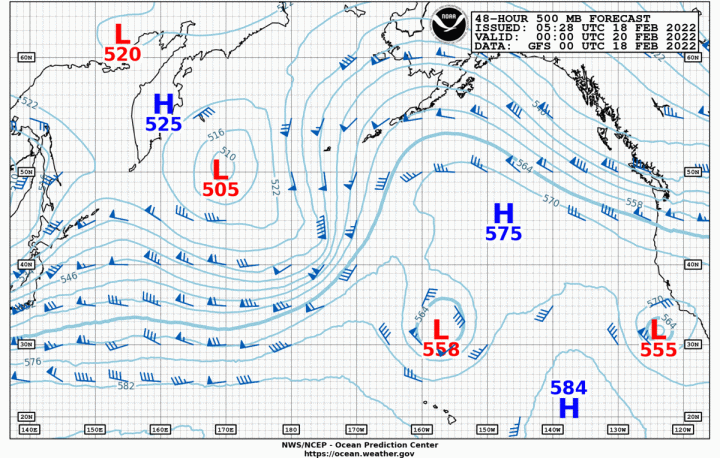
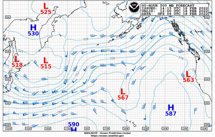
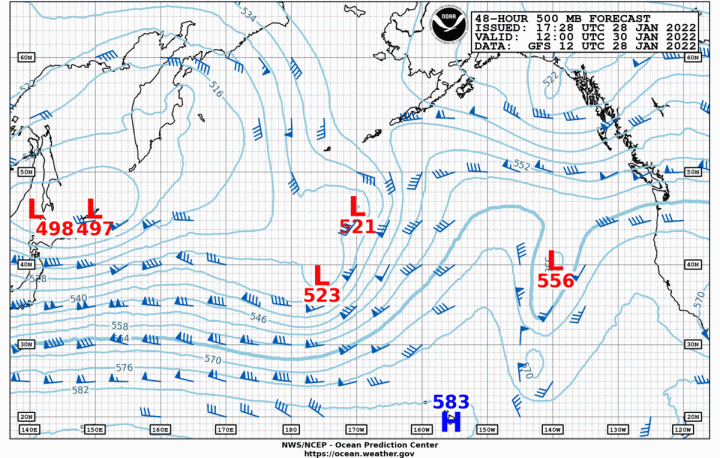
Today’s Surface Analysis Chart and Sat Pic show a weakening high-pressure system inland, with a series of moderate low-pressure systems poised to come into our area. The other feature of note is the 500MB Analysis which shows a shift in the path of the jet stream which will bring an end to our run of very chilly weather. Currently, the jet stream is going up and over the remains of our offshore high-pressure system and then coming ashore in Central California, allowing the cold air from BC to come into our area. As this hump in the jet stream moves east, the flow in the jet stream will remain zonal across the Pacific between 30°and 40°N, however, when the flow turns to the NE it will bring the more moderate temperatures back to our area. Finally!

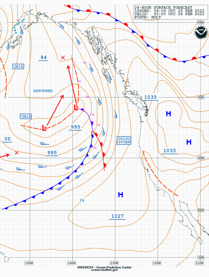
The Surface Forecast Chart for Saturday shows the next frontal system approaching the coast. As usually happens this time of the year, the front will slow as it approaches the coastal buffer zone. This will keep breezy conditions in place all along the coast for the weekend. The pre-frontal breeze will be strongest in the North Sound (20-25knts), Admiralty Inlet (25-30 knts), Eastern Strait of JdF, San Juan Islands, and Bellingham Bay (25-35 knts w/ higher gusts). The breeze will moderate about mid-day in the Central Sound and this moderation will move slowly north over the day. With frontal passage on Saturday night and into Sunday morning, the wind will become SW on the coast and SW in all of the Sound, Admiralty Inlet, Eastern Strait, and San Juan Islands. By noon, the gradient will begin to ease with the breeze dropping in the Eastern Strait but continuing at 15-20 knots out of the SSW in the Sound and Admiralty Inlet. 

By early evening on Sunday, conditions will return to pre-frontal in advance of the next system coming ashore on Monday, with more moderate temperatures. 

So plenty of fun to be had on the water this weekend, just be well aware of the conditions and make sure boat and crew are properly prepared. 

Bruce’s Briefs: Wx for 18, 19, 20, and 21 Feb. Should be a GREAT Toliva Shoal Race!

This could be one of the nicest Toliva Shoal Races in a long time with the weather, tidal currents, the sun, the moon, and the stars all in alignment. Plus whatever precipitation happens will be light and will only show up mid to late afternoon on Saturday. It will still be a bit on the coolish side but not below freezing but with wind chill, it will be close to it. Have plenty of warm fluids available especially for the folks hiking on what will be a long beat from Toliva back to the finish. My favorite is Chinese Hot and Sour Soup, recipe available on request.

Today’s surface analysis shows a now-familiar pattern of a stronger than normal high-pressure system offshore (1036MB) and a weak trough of low-pressure inland. A cold front will move down from the NW late Saturday and into Sunday however it will be a quick hitter bringing snow to the Cascades and Olympics and some lowland precipitation.

By early Saturday as the front begins its approach, the offshore high will begin to become stronger (1038MB) and rounder indicating more stability. This is what will allow a relatively strong flow of onshore breeze to continue over the area into the coming week.

For the Toliva Shoal Race, this will mean a fairly steady (for the South Sound!) SW breeze of 10 to 20-knots with the usual light spots in the usual places. Tacticians will love this race and the foredeck crews will be busy trying to anticipate the next gybe and/or the next sail change. At this point in the series, you know who the smart teams are and you’ll want to watch them for this race.

Tides are always interesting in the South Sound especially as you approach the Narrows. This year they will be pretty much with you around the course, AMAZING!

Budd Inlet Entrance

0906     Slack

1042     Max Ebb           .19 knts

1300     Slack

1542     Max Fld            .34 knts

1718     Max Fld            .30 knts*

2012     Slack

* Not an error

Narrows (south end)

1030     Max Ebb           3.13 knts

1342     Slack

1618     Max Fld            3.24 knts

1918     Slack

Have a great race, be safe, and enjoy the weekend.

Bruce’s Briefs: Wx for 11, 12, 13, and 14. It’s the BIG Seattle Boat Show and a beautiful weekend ahead!

Once again, the Pacific NW will be the envy of the country when it comes to weather, not traffic, but definitely weather. We will have an outstanding day tomorrow with temps approaching 60° F and sunshine. Slightly warmer on Sunday but with some cloudiness as the next cold front approaches our area for Monday.

Today would be the perfect day to do the delivery to Olympia for the Toliva Shoal Race with 15-25 knots of N to NE breeze all the way down the Sound. This follows the typical NW pattern of the best day for breeze is the first day the ridge establishes itself over the area with the breeze easing each day following.

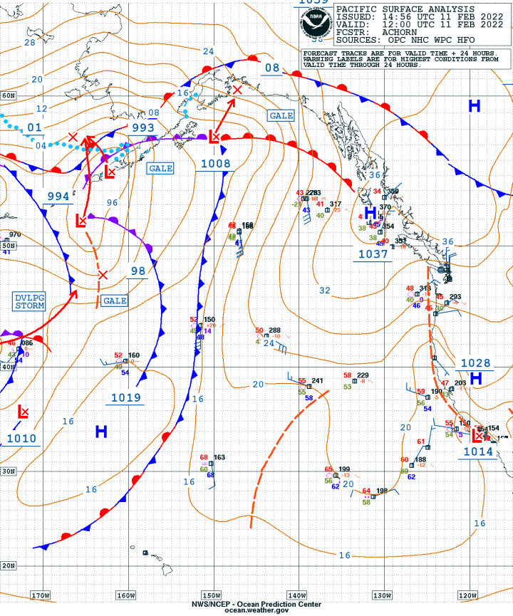
The surface analysis chart for today shows an irregularly shaped 1037MB high-pressure system extending from the Salish Sea into southeast BC. There is a nice compression of the isobars just to the north of us which is what is bringing us the strong N-NE breeze today. The chart for tomorrow shows the easing of the isobars which will bring lighter air however it really won’t go dead until late tomorrow night. This will mean ideal conditions of 5-12 knots of northerly for the winter Shaw Island Race, and the races in the central and south Sound.

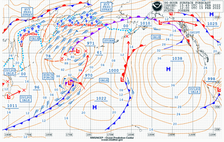
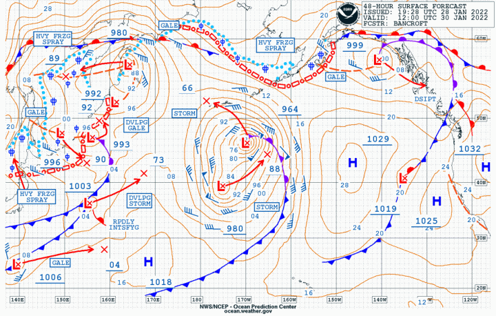
The most interesting chart for the weekend is the 48hr surface forecast chart which shows the deepest low we have had so far in the North Pacific, at 948MB and surrounded by hurricane force winds. It also shows the weak low-pressure system (1009MB) with attached frontal systems weakening as it approaches our coast and runs into our protective ridge of high pressure. This chart also shows how the pressure gradient is weakening over the area. The feature of interest on this chart is how a high-pressure system (1026-1029MB) is setting up off the central coast of California. This will be a continuation of the pattern we have seen since the start of the year.

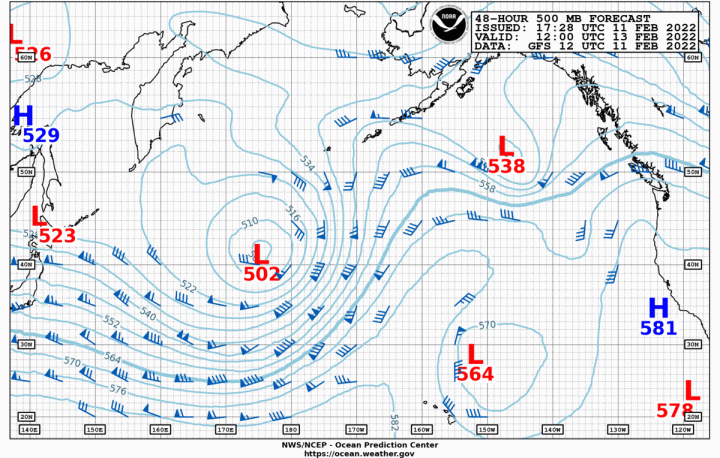
This pattern is reinforced by the jet stream maintaining its zonal flow over the western Pacific before it becomes meridional as it approaches our coast. This flow will become more interesting as the surface high-pressure off of California strengthens and becomes rounder in shape. Currently the jet stream is going over the top of the highs over our area and then sending those Alberta Clippers into the central US. By the middle of this coming week the jet stream will be going over the top of this building offshore high and then down into the Pacific NW. This will bring cooler temps into the area but probably not much moisture.

It will be a great mid-February weekend for our area so enjoy the Big Seattle Boat Show which closes tomorrow evening and then spend Sunday on the water.

Bruce’s Briefs: Wx for 28, 29, 30, 31 Jan. Rain is coming, just not much.

So much for this being a typical La Niña year. We may still be ahead for rain on this date however the long-range trend looks dry and not much more snow in the mountains, at least for the next week. Yes, we do have a frontal system coming in over Saturday night and into Sunday however that will start to ease on Monday with another ridge of high-pressure starting to build over the area.

To get the best feel for this start with today’s surface analysis chart and follow the sequence through 1 Feb. With tomorrow’s surface forecast chart, you can see the strong high (1040MB) inland with SEVEN centers of high-pressure over the western US and eastern Pacific. The offshore high is trending to drift to the north and this will continue to be a block for systems coming across the Pacific. This will be reinforced by the jet stream which will maintain its zonal flow over the Pacific before becoming meridional as it approaches the coast. This will also have the effect of bringing cooler temps into the Pacific NW.

If you’re sailing this weekend expect nice sailing on Saturday with breezy conditions on Sunday especially in Admiralty Inlet and the Straits with post-frontal winds of 25-30 knots. These will ease by late Sunday and into Monday morning.

Enjoy the weekend and especially the picture of the Tonga eruption with the remains of Cyclone Cody off to the SW of the eruption. Love those satellites!