Bruce’s Weekend Weather Brief

Bruce Hedrick usually posts for a specific sailboat race. This week we’re lucky to have an overview for the sailish, er, Salish sea. He’s watching closely in anticipation for Swiftsure and, later, Vic-Maui. Take him up on his offer to answer questions, he loves it. Just post at the bottom of this post under comments, and we’ll get him to answer you! – Ed.

It has been yet another very interesting week for weather in the Pacific Northwest with gorgeous sunshine ( in places), snow in the Olympics and Cascades , and heavy rain (in places). In other words, pretty typical springtime weather.

Looking at the surface charts one feature that really came to light this week was the setting up of the Pacific High which certainly should have the Vic-Maui and Pacific Cup teams licking their chops. Running the numbers for a start today, the Vic-Maui big boats could well have set a new elapsed time record. The same would be true for the Pacific Cup. For a brief period the High got up to 1038 millibars and was very round. Those two features tend to indicate the onset of some stability for the high. The bad news; it’s pretty early for that and there’s a lot of time before the start of either race. It definitely bears watching.

IMG_0476
What navigators do when nobody’s looking.

The weather for this weekend shows that we still have a weak but persistent low pressure system just sort meandering over the Northwest. This will tend to result in a mixed bag of conditions. For the central Sound on Saturday it looks like a perfect day for sailing with 10-15 knots of southerly for most of the day. What the Vashon Island racers wouldn’t have given for that last weekend! Swiftsure racers should be watching the weather in the Straits and note a fairly typical pattern of light air in the morning and a very breezy afternoon and evening with 25-30 knots from the west. Plan accordingly and at least be thinking about how you would deal with that on your boat. The long range forecast doesn’t look like that much wind for Memorial Day however it’s still a long ways out for any kind of accuracy.

Sunday shows yet another day of consistent southerlies in the Sound and a slightly weaker westerly filling down the Straits by late afternoon/early evening. Showers will be around so don’t leave the foulies at home and as always, keeps a weather eye out at all times.

Also, if you have any questions feel free to send them in and I’ll try to answer them.

Have a great weekend.


Bruce’s Brief for Vashon Island

Bruce’s Brief for Vashon Island

Almost the same story as last week since we really should be racing today. The drones were out early and showed solid northerly from Shilshole almost all the way to the bottom end of Vashon. It will not be the same tomorrow.

A glance at the surface charts shows a very interesting scenario with a series of weak, dissipating, slow-moving low pressure systems surrounding the Pacific Northwest. There are also weakening frontal systems attached to the lows that are offshore however they are dissipating as well. So while we have a lovely northerly today by early Saturday that will change to a southerly. The models (once again) are not converging so how this transition will occur and how it will affect us is not clear at this time. Oh well, it’s sailboat racing in Puget Sound.

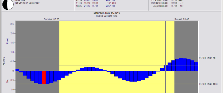
The tides however will be there and they won’t be bad as the first quarter moon is today which mean neap tides, not a lot of volume exchange.

Tides at West Point
0742 Slack
0927 Max Flood .2
1140 Slack
1506 Max Ebb .6
1835 Slack
2139 Max Flood .7

Tides at the Narrows
0732 Slack
0943 Max Flood 1.8
1238 Slack
1606 Max Ebb 2.2
1916 Slack
2214 Max Flood 3.2

As far as wind goes, one model has us starting in a dying northerly transitioning to a 10 knot southwesterly by noon to 1400 hrs. The other model has us starting in a due southerly of 10 knots which fades as we approach Pr. Robinson. All of which makes sense if you look at the surface charts. They send weather men to the Pacific Northwest to teach them humility, now you can see why.

By mid afternoon the models agree that we should have at least 8-10 knots of south-southwesterly breeze which will make for a nice run up Colvos to the finish. Both models have the big boats finishing the long course by about 1730 hours after a 0900 hrs start in very light air.
Before you leave the house check the Ferry Weather and the wind at Pt. No Point, West Point, and Point Robinson. Once you’re on the boat start logging the pressure reports and the station reports to try and get a feel for how this is changing.

Saturday will be the day that tacticians will earn their keep as they will have to keep trying to deal with a weather situation that is in a constant state of flux. For the crew, the trimmers will be working their tails off while the rest of the boat will be watching what is going on around them. Have the barber haulers rigged and be ready to go to a kite at any time. Wind seekers could be big money makers in the transition zones.

Have a great race.

Bruce’s Brief for Race to the Straits 2016

Bruce’s Brief for Race to the Straits 2016

As they say, you should have been here yesterday. It’s too bad they couldn’t have started the race today and then sailed back from Pt Townsend on Saturday. Would have had great breeze both days. Oh well, that’s sailboat racing in Puget Sound.

As you can see from the surface charts we’ve got a nice ridge of high pressure. However, there is also a cold front headed our way which will break up the ridge on Saturday night and keep things light until Sunday afternoon.

We’re just running into that same problem in that the best day for breeze is the first day the high pressure ridge rebuilds over the Pacific Northwest and that would be today. It will be cranking in the Straits (35+ at Race Rocks by mid afternoon Sat) and Admiralty Inlet today, tomorrow, and Sunday. Not so much from Point No Point south. So plan accordingly in terms of safety equipment. Since you’ll be going across Admiralty from Double Bluff to Marrowstone on a starboard tack, think about hoisting the headsail for the start in the port groove so you can do an inside set with the smaller jib when you need to change down.

The other problem is the tides and with a new moon today, which means Spring tides, the tidal flow is also going to be cranking. Good for Saturday not so good on Sunday.

Tidal Current in Admiralty Inlet

0525      Slack

0921      Max Ebb                 4.2 knots

1257      Slack

1603      Max Flood            3.4 knots

1921      Slack

Sunday

0606      Slack

1007      Max Ebb                 4.2 knots

1343      Slack

1652      Max Flood            3.4 knots

2014      Slack


Day 1 – Seattle to Port Townsend

The first start is just before 0800 hours and there should be a northerly breeze of 5-10 knots and with the ebb tide and a staggered start your plan should be (if you’re starting by yourself) to start on port at the Hamburger and head to the beach at Meadow Point. Tack to starboard and work your way towards the west by Jeff Head. This will keep you in the strongest part of the ebb. Once on the west side of the Sound stay in the strongest part of the ebb by watching your SOG and COG. Don’t get too close to the beach to the west and don’t get to the other side of the Possession Bar to the east.

Your next challenge will be the approach to the buoy at Double Bluff as the tide can really rip very close to the buoy. While from a distance it may appear you’ve left yourself some room, plan that there will be more ebb velocity the closer you get to the mark, and if it’s a warm day as forecast, there may be less wind in there as well. Don’t forget to take your GPS time as you pass the mark, and don’t forget to submit it when you finish, it’s a requirement.

(Click to enlarge)

After Double Bluff hold port tack as long as you can and then tack to starboard and get to the other side of Admiralty since the ebb lasts slightly longer on the west side. This will also put you in position to take advantage of the back eddies that occur up Marrowstone as the flood builds.

If you want to find out what the wind is doing at Port Townsend an hour before you’re going to get there go to https://rainwise.net/weather/bruce98136 . It’s my weather station on the north side of Diamond Point at the very mouth of Discovery Bay, looking right across at Protection Island.

After rounding Marrowstone Light tack to starboard to get yourself out of the flood tide and into the bay and flat water. Tack when you can lay the finish at R “2”.

Day 2 – Port Townsend to Seattle

Sunday will be somewhat more challenging as it will be a staggered downwind start from Port Townsend after a traditionally rowdy Saturday night party. You should have some wind (8-10 knots). The problem will be dealing with the ebb tide. There are more back eddies on the Whidbey shore, the flood starts first over there and boats have had success going over there in past races. The problem this year is that there will be less wind along the Whidbey shore. If you can work your way down Marrowstone and delay crossing over to Double Bluff, that should work better.

After Double Bluff you’ll want to work back to the Point No Point shore to take advantage of the stronger flood tide. After Point No Point it is going to get a little squirrelly until the northwesterly settles in late in the afternoon. When that happens sail your angles to the finish.

Have a great time, and be safe.

Ed. Note: Thanks, Bruce, for sharing!


Bruce’s Weather Brief for Sloop Tavern Blakely Rock Benefit Race – Sunblock Every 2-3 Hours!

If you liked last weekend, you’ll love tomorrow. Once again, the models are diverging as we get closer to race time. Not unusual this time of the year as the weather in the Pacific is trying to transition from winter to summer.

Wind speed vs air pressure at West Point

The Pacific High is still well south of its summertime residence and storm systems are pushing it around and keeping it from becoming more round, stronger and more stable. See the 1700 Surface Forecast Chart.

This slideshow requires JavaScript.

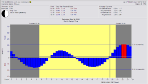
The only real known forecasts with a high degree of accuracy are the tides and currents.

Tides for tomorrow are:

0803      Low        6.35 feet

1258      High       8.7 feet

1939      Low         1.02 feet

Currents at West Point:

0846      Slack

1017      Flood     .16 knots

1220      Slack

1613      Ebb          .71 knots

2004      Slack


As you can see from the Surface Forecast Charts there is very little gradient over the Pacific Northwest. When you log the pressure readings at 1200 hours on Friday you find the following:

Forks                        1023.4

Bellingham          1023.1

SEA                            1023.4

PDX                           1022.6

In other words not much. What’s interesting is that there has been a northerly all night and this morning over most of the race area even though the National Weather Service has been forecasting a southerly for the morning then changing over to a northerly in the afternoon with the same for tomorrow, sort of. The culprit here is the Swihart effect which says that in the absence of a pressure gradient over the Pacific NW and the presence of abundant sunshine causing heating of the concrete and blacktop jungle known as the City and surrounding environs of Seattle, combined with a flood tide, will initiate a northerly  in the Sound. So with two days of beautiful, clear skies and temps near 70⁰ you’re getting plenty of heating. This will probably carry over to tomorrow, at least that’s what we’re hoping for. Regardless, you’ll still need to track the pressure gradients and the wind over the area, especially the ferry weather at Edmonds and Elliott Bay.

So if there is a northerly, how do we sail this race? The first item to check when you leave Shilshole and get out to the starting area is what is the flag doing at West Point. If it’s like this morning, you’ll notice a very slight shift to the NNE. When you start with a northerly, the first mark is Meadow Point so having to leave the mark to port always creates some interesting rounding problems especially for the deep draft vessels that would rather come in on port since the starboard tack approach can get you into some skinny water. Since there is a flood you’ll want to set with the pole to starboard and aim towards the mark at Blakely Rock. If you get slightly lifted as you get close to West Point, you might want to gybe to port. If there is a northeasterly at West Point there will be more wind under the bluff and you can hold that until you get lifted above Alki and your heading has you between Alki and Duwamish, then gybe back to starboard and aim at the Rock. Just don’t hit it….

On the way back from Blakely Rock put it on the wind on port tack and you’ll be heading towards the vicinity of Four Mile Rock. Tide may be slack or just starting to ebb so remember just how far out the shallow area goes from Four Mile to West Point. It almost always claims someone and with the ebb you’re going to be there for a while unless you get some help from the photoboat. Go in as close as you dare before tacking on to starboard. The puffs will be lifts and the person on the main and traveler will be working really hard to take advantage of each and every puff.

Once at West Point you’ll want to hold onto starboard tack to take you off the Point and stay in the ebb tide. Tacking too close to West Point will run you into the back eddy that sweeps along the north side of West Point. Tack to port when you stay outside of the restricted zone at the entrance to the Ship Canal. Then plan on one tack at the breakwater to make the finish.

This was the optimistic race forecast. On the other hand if it goes according to the forecast models and we start with a southerly that then clocks to a southwesterly and dies as we transition into a northerly in the later afternoon, it will be a matter of drag racing from puff to puff and sailing the shortest possible course. The big boats with tall rigs and code 0’s could have a real advantage on the reach/run back to Meadow Point. The next problem will be negotiating the rounding because the deep draft boats are going to have to tack immediately at Meadow Point because over the winter the sand bar has moved off the beach and there is now a bump to the north of the usual location of the bar.

Have a great race and don’t get sunburned!


Bruce’s Brief for Three Tree Point

Bruce’s Brief for Three Tree Point

It’s the last race of the Series and I could say that it’s going to be interesting. However, that is generally true every time you leave the dock to go sailing in the Spring in Puget Sound. What makes this more interesting than most days is the fact that the models have diverged instead of the usual converging the way they tend to as we get closer to the date in question. The reason for this can be seen in the Surface Forecast Charts for tonight and tomorrow. (Remember to subtract seven now to get from UTC to PDT.) As you can see, we have a weak area of high pressure to the east with an approaching front, tailing off of a weak and dissipating low pressure system centered off of southeast Alaska. That’s coming in off the Pacific with a weak high pressure system behind it.

The speed of this front has been inconsistent and generally speaking, weak frontal systems tend to slow as they get closer to the coast. As you can see, this cold front has been overrunning the warm front ahead of it creating an occluded front, very typical however when this occurs as the fronts approach the coast it makes it difficult to predict how fast the front will come onshore. Hence, the word interesting.

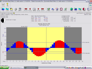
Tomorrow’s race will all come down to how we handle the highly variable conditions. Combined with the following tides at West Point:

0603                        Slack

0919                        .9 Ebb

1303                        Slack

1548                        .7 Flood

1907                        Slack


It will be challenging to say the least. Based upon this morning’s GRIB files we’ll probably have 3-5 knots from the SSE to start, with the wind slowly clocking around to SSW and 4-8 knots at 1330 before it starts to back and slowly build from the SSE and maybe getting up to 8-10 knots.

West Point wind vs pressure plot

For the big boats that will mean finishing at 1500-1600 hrs, in other words right at max flood.

So in these variable conditions and a lot of sailing in anti-water it will be important to remember that the shortest possible course will be down the East side of the Sound. Keep a hand bearing compass handy to track how any defectors to the West might be doing. There will be a fair amount of current at West Point and there will tend to be less wind in Elliott Bay so holding port tack out from West Point will get you into less tide and should keep you in more breeze. It’s usually picking your way across Elliott Bay to Alki that can create both major gains and losses. From Alki south to TTP it will be a matter of finding the best breeze and trying to see if there’s a pattern to the oscillations.

The run home from TTP could be very interesting as one set of GRIBs has the wind around to 230-240⁰M at 6-8 knots which could mean Code O’s for the fast boats. The NAM GRIBS have the wind staying between 185⁰ and 200⁰M. Either way, trimmers and drivers are going to have to be working very hard. Since we’ll be fighting the flood all the way north, the temptation will be to stay east out of the flood while still sailing the polars and keeping the boat at targets. Ideally, you’d look for shifts to gybe back to the east to get out of the flood if you find yourself sailing in anti-water however if there has been any clearing during the day in the afternoon this will cause the wind to lift off the east shore so it may get light if you get in too close. Eyes out of the boat!

Click on any image to enlarge:

So in the morning get every extra ounce of non-essential gear off the boat, drain the water tanks and take only enough fuel to get safely home from TTP. It’s not an overnight race so don’t let the crew bring huge seabags with a change of clothes for every watch change and the post race party. Bring on board only what you are wearing and going to eat. Carefully log the pressure from your WX-VHF so you can track how fast the front is coming ashore. Before you leave the house check the Washington State Ferry Weather, the NDBC West Point(WPOW1) Plot of wind and pressure, and the NWS radar at Langley Hill to see if the front is showing up on the Doppler. During the race track the pressure changes and wind velocities at the stations north and west of West Point as the south-southeasterly will move south and build from that direction.

Remember also that it can get a little shallow at TTP so resist the temptation to cut it too close. If there was ever a place to make sure the crew is all on the same page, thinking three maneuvers ahead, and the driver and tactician are anticipating mark rounding situations, it’s at the rounding mark “C” at TTP. Don’t hesitate to talk it through, the foredeck will greatly appreciate a plan that you can stick to.

Have a great time and a safe race.

Bruce’s Brief: Scatchet Head Race

Bruce’s Brief: Scatchet Head Race

I think we will agree that we’ve had enough wind this week, but going north to Scatchet Head we’d really like to have enough to get all the way around the course.

Well, even though we are between fronts again, it definitely looks like we will have breeze. In a nutshell, the breeze will be stronger in the morning (15-20 knots)and building as you sail north (20 to 25+knots). On the beat on the way back the breeze should ease a little and then start build again. See the 1500 hour MM5 chart with 30 knots possible in the Richmond Beach –Pt Wells area.

West Point Wind Plot

There is another fairly strong system approaching the coast however it won’t get here until Sunday late afternoon or early evening. Look for a southeasterly in the starting area becoming a building due southerly as you work your way north to the mark. So be prepared before you leave the dock in the morning with the crew all in pfd’s, safety harnesses, and tethers, with the jacklines rigged and in place.

Next think about which headsail you’ll want to use for the beat back from Scatchet Head because that’s the headsail you’ll want to use in the starting area for this downwind start. Next, anticipate where you’ll want to do your final gybe before the mark in the building breeze.

Currentrs Scatchet HeadThe tide will be at near max ebb in the starting area so don’t get caught below the line trying to beat back up with a tide trying to push you to north and your entire fleet reaching over the top of you giving you a massive dose of dirty air.

You will probably hold the starboard gybe off the line until about halfway to the Richmond oil docks where the breeze will start to clock and lift you. That’s when to gybe to port and work your way back to the center of the Sound. Between the oil docks and the Edmonds Ferry Dock you’ll probably want to gybe back to starboard. You’ll hold starboard until you can gybe back to a layline that is east of the Scatchet Head mark. Why? Because the ebb tide will be pushing you towards the mark to pushing you to west and past the mark. The ebb will probably be flowing at 1 to 1.5 knots flowing due west as you approach the mark.


Another possibility is that if it is really cranking as you sail north and you don’t feel particularly comfortable about gybing, sail past that layline and then drop the kite behind the headsail, get everything under control and then do the gybe. This way you’ll have plenty of time to get your fast settings for the beat before you get to the mark.

You’ll probably round and come up on to a port tack. Only hold this for about 100 yards at the most before you tack back to starboard and get to the Edmonds shore. The ebb is going to last until around 1400 hours and maybe longer as there will be plenty of water coming down the Snohomish River and out Possession Sound. Since we’ll all have a couple of hours of ebb to fight after rounding you may want to think twice about going to the west as that would mean having to cross the ebb twice to get to the finish. Going to the east has two advantages. The first being that after you get off the Possession Bar and you can start to see north into Possession Sound you’ll begin to get the advantage of the ebb flowing south out of Possession. The water will also get flatter and there will be a very localized south-southeasterly along that beach which will allow you to hold port tack as you sail roughly parallel to shore north of the Edmonds Ferry Dock. The breeze may also lighten as you get in closer to the beach. Watch your COG and SOG on port, and when you get back out into anti-water, tack back to starboard and go back into the beach.


As you beat past the Ferry dock, the breeze will once again stay out of the due south and you’ll be in the ebb which will begin to ease around 1500 hours. it will be about .3 knot less on the east shore than if you were fighting it on the west shore of the Sound. Remember also that from Edmonds south to Point Wells there is a very shallow area that goes out quite a ways so watch the sounder. The same as you go from Point Wells to Richmond Beach. South of there it will be a matter of finding lanes of clear air, working the beach and not spending too much time out in the ebb.

As you come up the beach and get closer to the finish off of Meadow Point don’t go so far in that you overstand the finish. It’s OK to tack to port to come off the beach with some in the bank because the ebb and the flow out of the Ship Canal will push you below the layline and you probably don’t want to have to tack back to starboard to get to the finish.

Be safe and have a great race.

(Feature photo – courtesy Jan Anderson – of Absolutely coming back to Seattle with a broken mast. The new Absolutely is looking good and chances are Charlie Macaulay and company will very careful with their gybes this year!)


Bruce’s Brief – Blakely Rock Race

Oh this is exciting. My buddy Bruce Hedrick is sharing his insights about tomorrow’s CYC Blakely Rock Race. If you don’t know Bruce, just ask around or come back here soon, ’cause I’ll have an explanation of just why you should listen to him on these pages as soon as I have a minute.

It’s the start of March so it’s got to be time for the best sailing series on Puget Sound, the CYC Center Sound Series. The first race is the Blakely Rock Race which is tomorrow, March 5th, and in keeping with the year so far, we’ll have wind for the start and then it will start to drop. At least it won’t be super wet as this front is coming through this afternoon and this evening, and the next one isn’t due until Sunday .

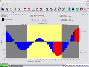
Unfortunately we’ll be between fronts so it could get a bit squirrely out there tomorrow and the first folks around the course will have an advantage, especially as the tide starts to ebb at around 1300 hours. Just remember that with consistent southerlies the ebb will start sooner and last longer. With the max flood being the small flood of the day and only .2 knot it may not even show at West Point as the water is rolling out of the Duwamish and with the freshwater staying on top of the salt water it just may ebb all day at West Point.

Currents WP
Tides

Tides based upon West Point

Slack                0851

Max flood        1042      .2 knts

Slack                1253

Max ebb           1647      .9 knts

Slack                2032

The current is also ripping out of the Ship Canal as the ACoE is trying to make sure there won’t be too much water in Lake Washington and Lake Union and with more rain projected to be on the way, all the spillways at the Locks are open. So depending upon where CYC sets the starting line, you’ll have to adjust your tactics accordingly for getting over to the Bainbridge side of the course. You’ll want to get out to the start line early especially if you’re going to try and sail your team into racing shape and this is your first sail of the year. Check the set at the starting line and if CYC has set the line well off of Shilshole you’ll want to see if there is any flood showing up at all in the starting area. If there is, there will be a clear line of demarcation as the flood meets the ebb from the Locks and from the Duwamish. So if you start on starboard in flood tide, only go on starboard until you can see the ebb and then tack to port and beat feet to the west. The wind should be out of the due south with a very slight knock as you get to the west side of the Sound. Work your way down to Blakely Rock and don’t feel like you have to go all the way into the beach at Bainbridge as the wind and current may be better slightly offshore.

It will be the leg from Blakely Rock north to the temp mark that will be east of the VTS buoy where it may get light and squirrely. Typically the breeze lasts longer on the west side of the Sound as it starts to die away. Unfortunately, the MM5 charts show the Sound starting to look like Swiss cheese at around 1300 hours. Luckily you’ll have ebb to sweep you up to the top mark.

Coming back from the top mark you may have to deal with a light northerly and as that fills in, you’ll want to make your way to the beach north of Meadow Point to stay out of the building ebb. From there it will be gybing to stay in the wind and out of the tide as you work your way to the finish.

Wind speed vs air pressure the last few days at West Point.

In the morning before you leave house you’ll want to check the conditions at West Point(WPOW1), the Washington State Ferry weather, and if you subscribe to (highly recommended) the OCENS GRIB + program, you’ll want to download the most recent NDFD HiRes and GFS HiRes GRIB files to get an even better feel for what is going to happen.

When you get to the boat, do your normal rigging but set up for light air on the run and make sure you’ve got the light barber haulers set up on both the port and starboard side so you can go to it immediately without having to do the set-up on the course.

The above all else, keep your head out of the boat and watch what is going on around you. You should know who the fast folks are so keep an eye on them as well.

Good luck and have a great day!

Bruce Hedrick